
Atelier Compatibility Sustainability of Architectural Restoration E
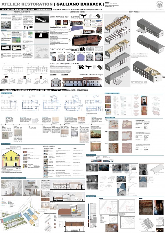
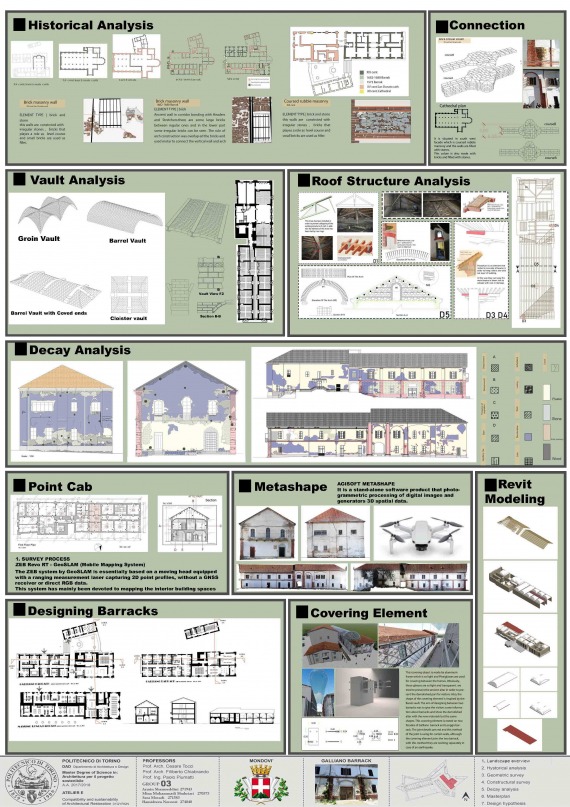
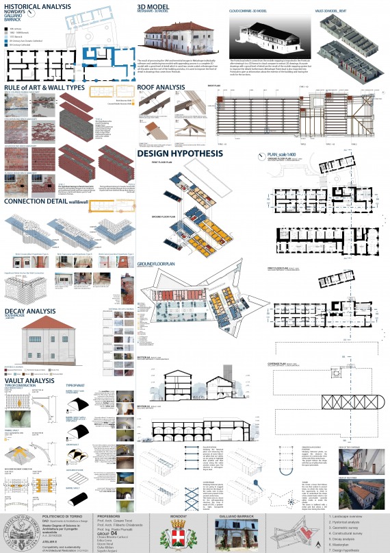
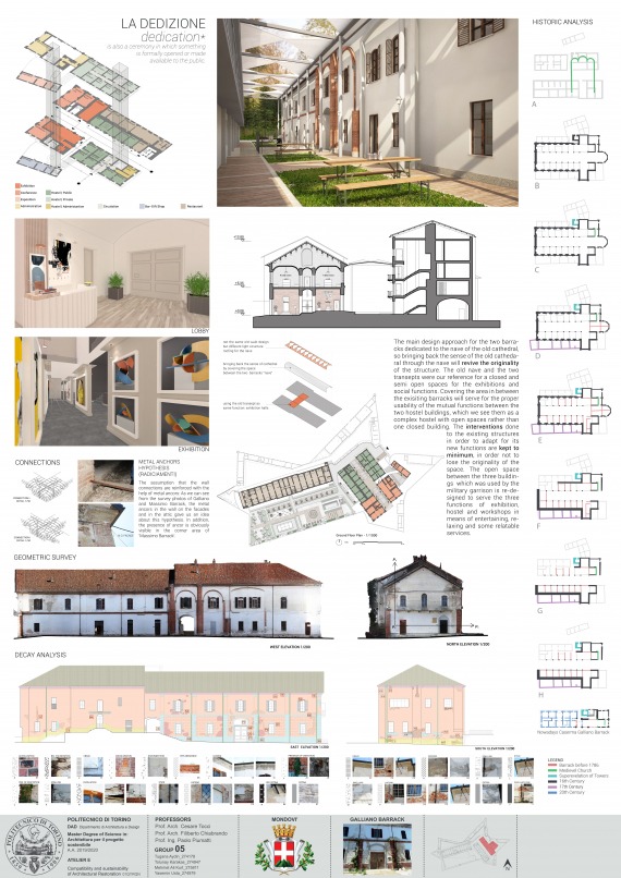
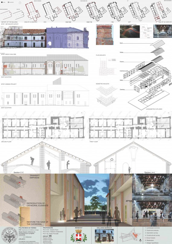
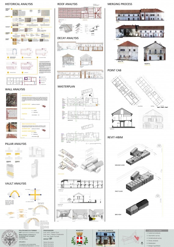
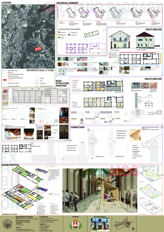
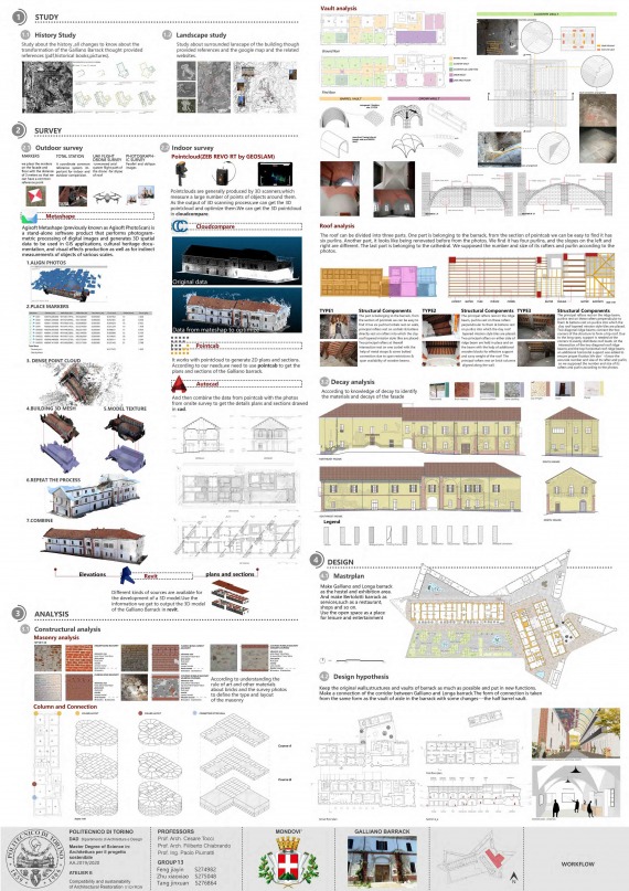
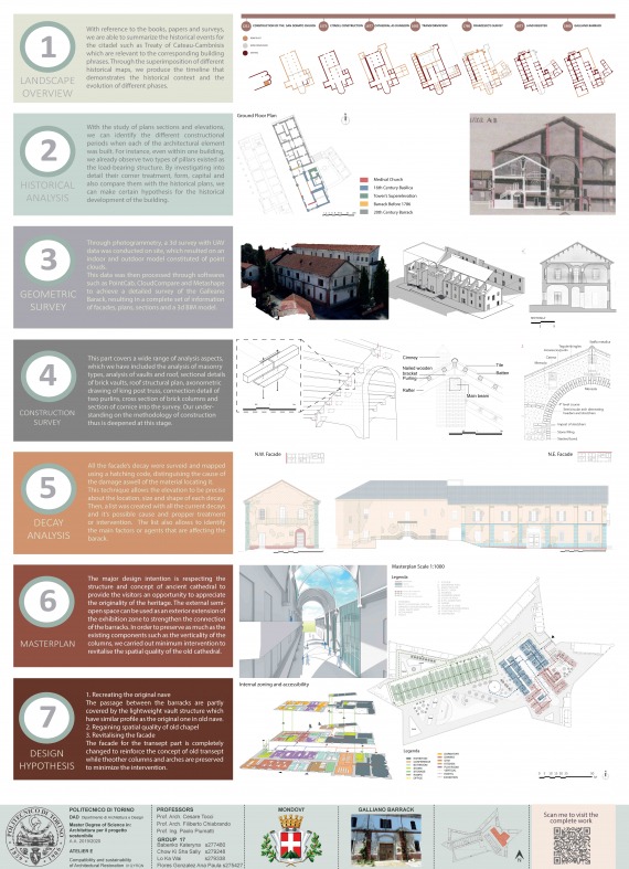
The LAB activity that students were asked to develop concerned the ‘Caserma Galliano’, a building belonging to a wider military complex in the historical centre of Mondovì (CN), built on the remains of a church dating back to the XIV century and still recognizable inside the present barracks.
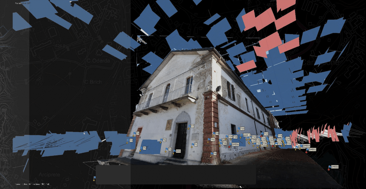
Continuously flanking advanced techniques and traditional tools, the Caserma has been dealt with by direct (on the building) and indirect (on bibliographic and archive sources) methodologies: the former has been carried out by means of a virtual photographic survey prepared in advance thanks to the exercises of previous years, the latter has been greatly simplified, providing students with a critical (translated) selection of original sources (to overcome, or at least reduce, difficulties unavoidably experienced by foreign students).
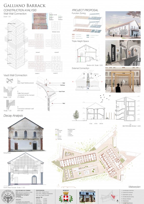
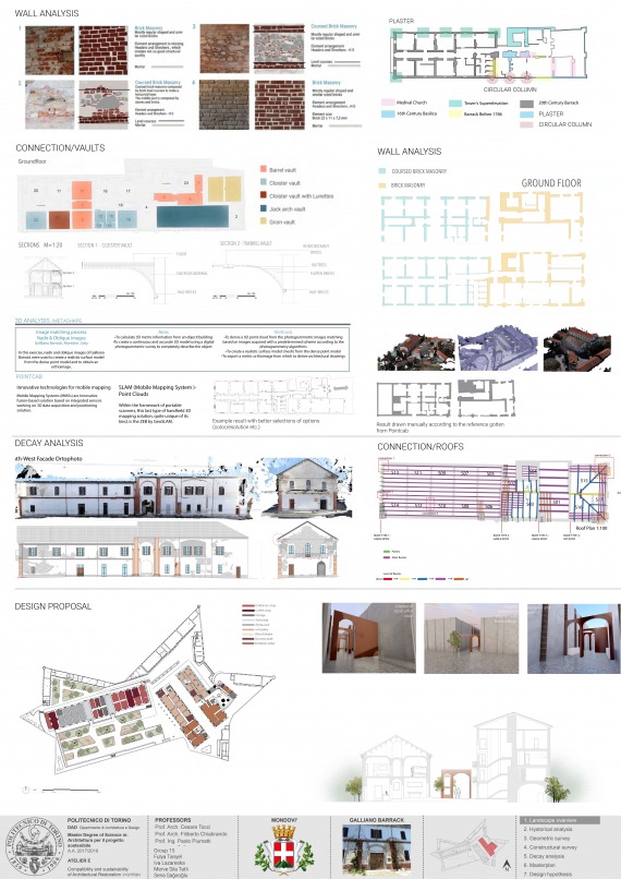
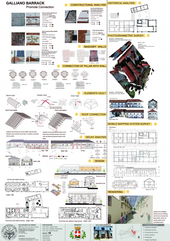
Being characterized by relatively small dimensions and constructional apparatuses easy to survey, the Caserma has been analyzed trying to understand its relationship with the military citadel and, above all, its constructional and structural consistency. As for these latter, the Caserma turns out to be a paradigmatic example of the sustainability of historical constructions always built with local material, using techniques belonging to a specific context and experimenting solutions implicitly aimed at reducing the consumption of resources. For the same reasons, the very design phase can comply with the requirements of sustainability, from both the economic and cultural point of view, if the peculiar nature of the building is recognized and valued.
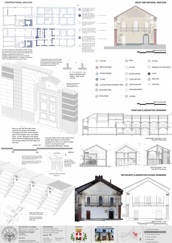
The Restoration unit was mainly devoted to the analysis of this peculiar nature of the building (knowledge) in order to understand its main weaknesses as well as its strengths (interpretation) and, finally, derive consistent intervention choices (design).
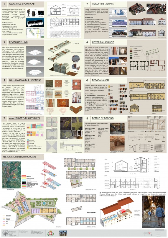
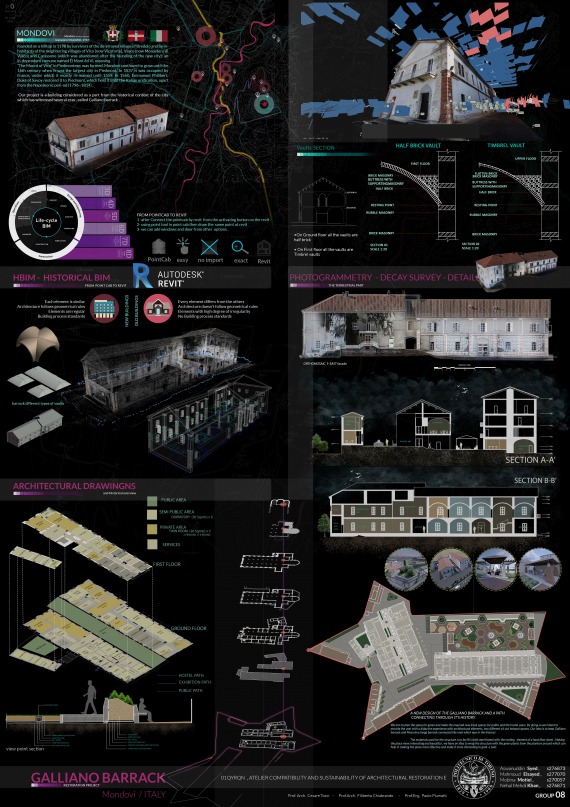
The Geomatics and Drawing unit were focused on new methods and technologies for 3D survey and representation. On-field data acquired in previous years (using LiDAR instruments, topographic surveys and photogrammetric acquisition with the use of drone as well) were processed using commercial and open source software in order to obtain 3D point clouds, 3D models, orthophotos and Digital Surface Model (DSM). 2D drawings were then extracted from the achieved 3D point clouds and a parametric 3D model (HBIM) was realized to gather and systematize all relevant building’s data (historical phases, constructional features, decay phenomena).